Route Optimisation
Route-planning and optimisation involves juggling many constraints related to safety, operations and compliance. For ship captains, this is an essential and complex task that requires the aid of a decision-supporting tool to give them confidence in their decisions and support execution.
GTT has developed an advanced route optimisation solution that is capable of advising the best route by optimising numerous parameters and respecting a large number of operational constraints. The solution is suitable for all types of vessels (tankers, bulkers, container vessels) and all types of propulsion and fuel. Furthermore, combined with the other features of GTT’s Digital Platform, it offers a powerful tool for all the stakeholders to collaborate to reach the organization’s operational and economic objectives.
Among the optimisation options, we can highlight optimisation of:
- Voyage duration
- Voyage distance
- Fuel consumption
- Cost (including fuel, daily cost, canals, carbon tax…)
- Emissions (taking into account the conversion factor of each fuel)
- Ship motions (Parametric / Asynchronous rolling, surf-riding/broaching-to, successive high-wave attack…)
For LNG carriers, there are specific advanced features:
- Sloshing prediction
- LNG cargo loss prediction (while complying with the discharge terminal constraints)
The algorithm is highly flexible and can be customised with any cost function in order to be optimised.
Furthermore, the algorithm takes into consideration many constraints:
- Ship dimensions for navigational constraints
- Weather limitation (wave height and wind speed)
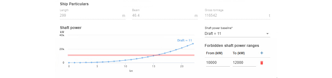
- Forbidden Power/Speed ranges
- Cargo types (for international and local routes restrictions)
- Specials areas (with maximum or minimum speed, no-go area)
- Traffic Separation Schemes
- Maximum CII (Carbon Intensity Index)
As far as CII is concerned, the route optimisation module in particular, and overall platform in general, offer all the features requires to manage the operational implications for the different stakeholders. Indeed, the new regulations require the ship owner and the charterer to collaborate closely not only to monitor but also to optimise the CII score of the vessels. Special contractual clauses will have to be activated in case the CII score starts falling below the agreed limit obliging the two parties to agree on operational corrective measures. Thanks to its predictive capabilities (fuel consumption, CII, distance…), the route optimisation module can play a key role in that framework by offering a collaborative platform for all the parties.
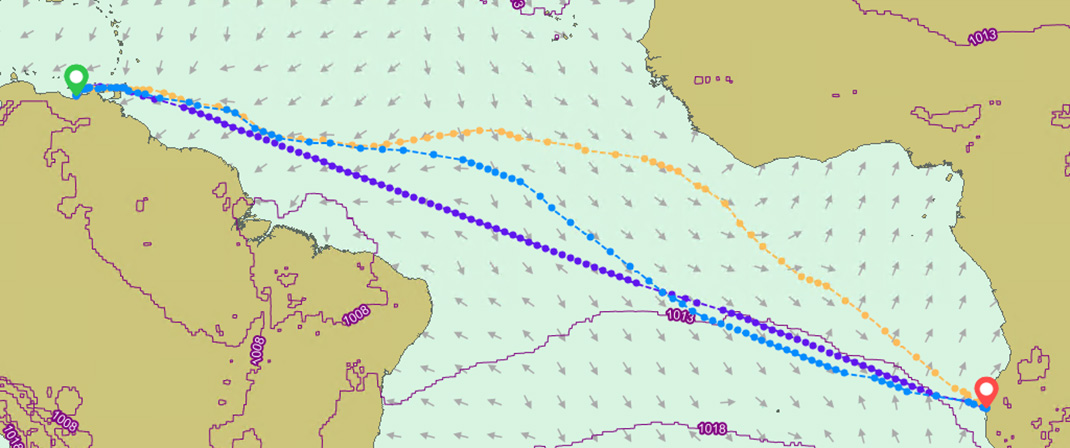
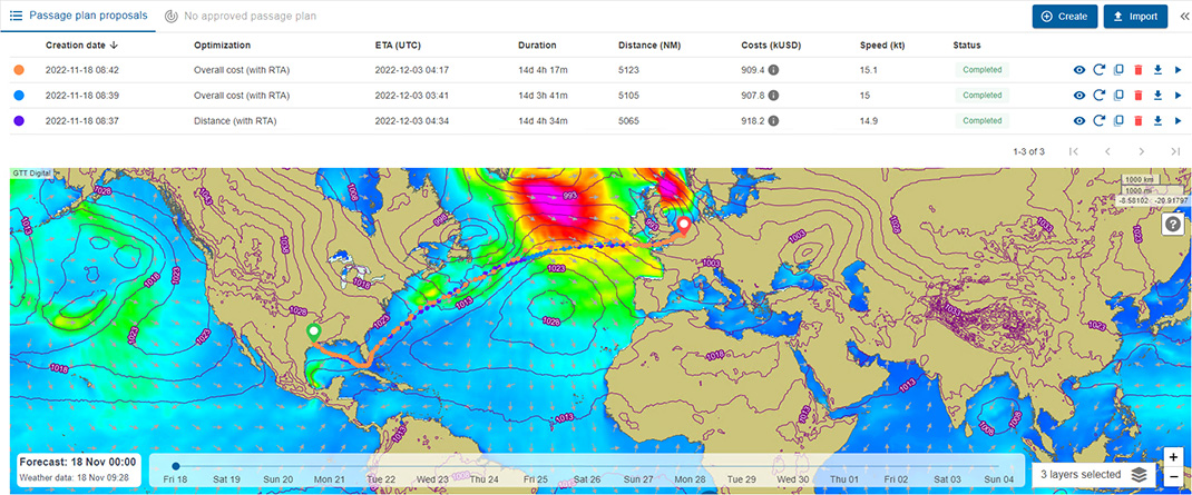
Depending on the optimisation criteria selected by the user, the routes can be very different. In the above example, we see three routes corresponding to three differents criteria:
- Least fuel in orange
- Shortest distance in purple
- Lowest total cost in blue
In this simulation, other parameters has been set and taken into consideration like the daily costs, the fuel costs, the minimum speed and maximum speed. In this example, the savings achieved in the “lowest cost” scenario in comparison with the “shortest distance” scenario is about 10%.
In order to provide the most accurate advice, the software uses the vessel’s digital twin built based on the available vessel data and parameters. It takes into account the sailing conditions (e.g. draft, speed, fuel…) and the environmental conditions (e.g weather factors). This can include the vessel’s dimensions, sea trials, noon reports, maintenance records, sensor data…
To deliver the best performance the algorithm favours constant power profiles. In fact, when a vessel meets adverse weather conditions, such as high significant waves, strong wind and currents, it must output more power and thus consume more fuel to maintain its speed and revolutions per minute (RPM). Rather than allowing the power and the fuel consumption to spike, the software recommends a RPM that stabilizes them while respecting the voyage commercial constraints.
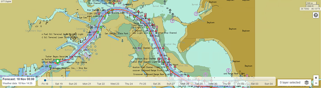
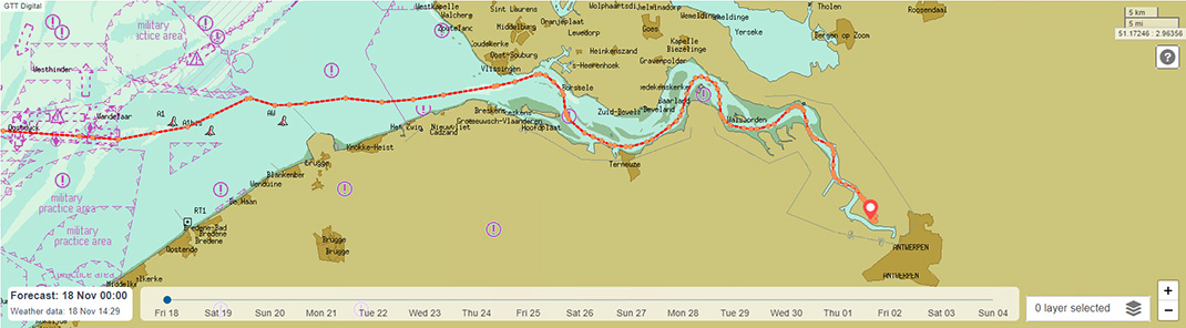
Last but not least, up-to-date Traffic Separation Schemes (TSS) are taken into account to offer the most realistic route possible, ready to be used by the crew. In fact, this reduces the captain’s burden adapting the route to navigational constraints and increases the trust in the suggested routes and the overall solution. Furthermore, the more the route is amended for commercial or safety reasons, the higher the risk of deviation from the performance optimum.